Tracking the information about your manuscript
Communicate with the editorial office
Query manuscript payment status Editor LoginCollecting, editing, reviewing and other affairs offices
Managing manuscripts
Managing author information and external review Expert Information Reviewer LoginOnline Review
Online Communication with the Editorial Department
Downloads
Page Views
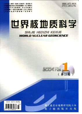
About the Journal

Former journal titles:Foreign Uranium Geology;Overseas Uranium and Gold Geology;Foreign Radioactive Geology
Sponsor:Beijing Research Institute of Uranium Geology
Publication frequency:Bimonthly
ISSN: 1672-0636
CN: 11-4914/TL
Place of Publication: Beijing, China
Language: Chinese
Format: Large 16K (A4)
Postal Subscription Code: 82-407
Year of Inception: 1962
Study on the metallogenic environment and regional metallogenic regularities of sandstone-type uranium deposits in the China-Mongolia border and adjacent areas
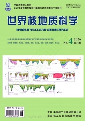
LIU Chiheng;CAI Yuqi;LIU Wusheng;LIU Zhengguo;REN Hong;ZHANG Yunlong;SUN Xiang;YANG Ze;SONG Jiye;JIA Licheng;National Key Laboratory of Uranium Resources Exploration-Mining and Nuclear Remote Sensing;Beijing Research Institute of Uranium Geology;The China-Mongolia border and adjacent areas host a series of Late Mesozoic rift basins that constitute an important sandstone-type uranium province in Central Asia. To clarify the uneven distribution of uranium deposits, the differences in ore-bearing horizons, and the regional metallogenic controls, this study compares the Yin-Ejin,Erlian,East Gobi,and Hailar-Tamtsag basins within a unified cross-border tectonic framework. Seismic profiles, tectono-stratigraphic correlations, basement attributes, sedimentary systems,paleoclimate records,and representative deposits are integrated. The results show that these basins formed in a wide rift system related to post-orogenic lithospheric extension, thinning, and gravitational collapse, and generally experienced syn-rift fault-depression subsidence followed by post-rift sag subsidence. Ancient basement rocks and uranium-rich magmatic rocks provided the principal "infiltrationtype" uranium sources, while uranium-rich dark mudstones and source rocks in faulted lacustrine basins could also serve as "exudative" uranium sources. Sandstone-type uranium deposits can be divided into faultdepression and sag types. The former is controlled by proximal uranium sources,boundary faults,basement paleochannels, and fan-delta sand bodies, and the scale of mineralization is constrained by structural segmentation of the fault depressions. The latter is jointly controlled by regionally extensive longitudinal fluvial channel-deltaic sand bodies, stable oxidizing fluids, and exudative uranium sources from deep fault depressions,and represents the principal setting for the formation of large to super-large deposits. The end of Early Cretaceous climatic shift from relatively humid to semi-arid or arid conditions promoted uranium leaching, reducing-media formation, and oxidized uranium-bearing groundwater circulation. This study indicates that the spatiotemporal coupling of fault-depression-sag structural transformation, sand-body connectivity, climatic transition, uranium-source effectiveness, and preservation conditions is the key control on large-scale sandstone-type uranium enrichment in the China-Mongolia border region and adjacent areas.
Geological characteristics and metallogenic ages of uranium mineralization in Huanghuagou area,northern Junggar basin
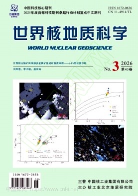
ZHU Bin;WU Yu;ZHONG Jun;CHEN Hong;MAO Guangzhen;YANG Yanbo;National Key Laboratory of Uranium Resources Exploration-Mining and Nuclear Remote sensing;Beijing Research Institute of Uranium Geology;Three types of uranium mineralization have been identified in sandstones of the Lower Cretaceous Tugulu group in the Huanghuagou area, northern Junggar basin: apatite-type, infiltration-type, and supergene-type. Detailed petrological, mineralogical, geochemical, and geochronological studies on these three types of uranium ore samples yield the following insights: 1) In the apatite-type uranium ores, no independent uranium minerals are developed; uranium occurs as an isomorphous substitution in microcrystalline apatite, which exists as cement. A whole-rock U-Pb isochron age of 76.5±6.6 Ma was obtained, indicating that the mineralization occurred during the sedimentary hiatus between the Upper Cretaceous Honglishan formation and the Lower Cretaceous Tugulu group. 2) In the “infiltration-type”uranium ores, coffinite is the main uranium mineral, spatially closely associated with plant fragments and pyrite. Uranium mineralization is located at the redox transition zone. U-Th-Pb chemical dating of uranium minerals yields an age of 11.5 Ma, suggesting that the “infiltration” uranium mineralization took place during the sedimentary hiatus between the Neogene Suosuoquan formation and the Paleogene Ulunguhe formation. 3) The supergene-type uranium ores are the oxidized surface remnants of the “infiltration-type” uranium ores, in which uranium occurs as secondary uranium minerals(carnotite, tyuyamunite, and metatyuyamunite). Lead contents in these uranium minerals are below the detection limit, indicating that the supergene alteration occurred during the Quaternary. Based on the characteristics of the three uranium mineralization types, it is concluded that future uranium exploration in the Huanghuagou area should focus primarily on the “infiltration-type” uranium deposits.
Sedimentary characteristics and uranium metallogenesis of the lower member of Atushi formation in Wupaer segment of Kashi sag,Tarim basin
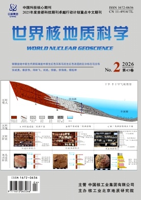
SUN Fei;WANG Shouyu;YANG Wenlong;LYU Junwei;LI Zhenhuan;YUAN Zhong;LIU Nian;The lower member of the Upper Series Artux formation in the Wupaer area, Kashgar sag, Tarim basin, serves as the main host horizon for sandstone-type uranium deposits. Investigating its sedimentary characteristics and uranium mineralization is of great significance for guiding uranium exploration in this region. Based on comprehensive analysis of field reconnaissance, core observation, and borehole data, a series of maps including isopach maps of the lower Artux formation and sand body thickness were compiled. Combined with oxidation and mineralization information revealed by boreholes and surface outcrops, the sedimentary facies and mineralization processes of the lower Artux formation were systematically analyzed.The results indicate that the sandstones in the lower Artux formation of the Wupaer area are mainly fine-to medium-grained feldspathic sandstone and feldspathic lithic sandstone. The ore-bearing host rocks contain carnotite, phosgenite, and pyrite. The study area is primarily characterized by alluvial fan and deltaic deposits. The alluvial fan facies can be subdivided into middle fan and inner fan subfacies,while the deltaic facies can be subdivided into microfacies such as deltaic plain distributary channels, deltaic plain interdistributary depressions, deltaic front subaqueous distributary channels, and deltaic front interdistributary bays. The facies transition zones between the deltaic plain distributary channels and the deltaic front subaqueous distributary channels are favorable for uranium mineralization. The uranium mineralization is evidently controlled by the interlayer oxidation zone and regional tectonics. It generally experienced stages of initial uranium enrichment, phreatic-to-interlayer oxidation transition, continuous development of the interlayer oxidation zone and uranium mineralization, and differential development. The area extending from the west of Tashdalan to Yoder, Xianazar, and southeast of Biaoerkuoyi village on the north limb of the syncline in the study area is a favorable zone for uranium mineralization, and can serve as a key target area for the next phase of sandstone-type uranium exploration in the Artux formation.
Comprehensive analysis of sandstone-type uranium metallogenic conditions in the eastern depression of the Yemajing area,northern Jinta basin
ZHANG Zilong;WANG Fenggang;ZHOU Junjie;WU Guodong;LIU Xu;WANG Jibin;HE Feng;WU Qun;ZHNG Yan;TANG Ailin;National Key Laboratory of Uranium Resources Exploration-mining and Nuclear Remote Sensing;Beijing Research Institute of Uranium Geology;The eastern sag in the Yemajing area of northern Jinta basin is a typical intermontane depression,where the uranium geological research is currently limited. To explore the uranium mineralization potential of small depressions surrounding uranium-rich pluton, this study systematically analyzed the sandstone-type uranium metallogenic conditions in this area using comprehensive techniques including geological profile surveying, ground gamma spectrometry, electromagnetic survey, areal soil radon gas measurement, trace element analysis, and scanning electron microscopy. The results show that uranium-rich Carboniferous monzogranites(surface grab samples uranium content up to 102×10-6) are widely exposed around the depression, and the Lower Cretaceous Xiagou formation itself exhibits pre-enrichment uranium characteristics,indicating superior uranium source conditions. The depression as a whole exhibits a synclinal structure developed within a “U”-shaped catchment configuration. The Xiagou formation has a “mudsand-mud” sequence, with vertical sandstone thickness generally ranging from 40 to 260 m, and the epigenetic alterations are dominated by phreatic oxidation and surface leaching. The surface radioactivity is high(average uranium content of sandstone 91.9×10⁻⁶,maximum 217×10-6),and the soil radon anomaly is of extensive area. Uranium and associated minerals such as pitchblende, anatase, and thorianite can be identified in surface ores. The above findings confirm that this depression has favorable uranium metallogenic conditions, with the mineralization type being sedimentary-diagenetic plus phreatic oxidation(basal paleochannel type), but the mineralization scale may be limited. This research provide a reference for sandstone-type uranium exploration in similar small basins(depression zones) in northwestern China.
Metallogenic characteristics and mineralization of uranium deposits in Huanglongpu area of Luonan,north Qinling metallogenic belt
LIAN Kang;WANG Tian;FENG Wei;The Huanglongpu region is located at the convergence of the northeast-trending molybdenum-leadzinc-copper metallogenic belt within the North Qinling orogenic belt and the northwest-trending uraniumniobium-REE-rare metal metallogenic belt. It hosts notable uranium and polymetallic mineralization. This paper systematically summarized the uranium metallogenic structure, orebody characteristics and ore characteristics, and discussed the geochemical characteristics and alteration zoning of uranium deposits in the Huanglongpu area. Uranium deposits primarily formed during the post-collision extensional and tensile phase of the Qinling orogeny, controlled by NW and NE-trending faults. The main host rocks are NEoriented K-feldspar-bearing quartz-carbonate veins,with subordinate NW-oriented counterparts. NW faultrelated mineralization predominantly occurs as vein or stratiform bodies, while NE faults produce more complex, lensoid or disseminated mineralization. The carbonate veins are enriched in incompatible elements such as U, Sr,Ba,and REEs,exhibiting a right-leaning REE distribution with light REE enrichment. In the pre-mineralization stage, K-feldspathization and biotitization were developed; the main mineralization stage was characterized by silicification and pyritization; the post-mineralization stage developed sericitization, chloritization, carbonatization, kaolinization and limonitization. The alteration exhibits distinct horizontal and vertical zonation, consisting of an inner zone(intense alteration zone), middle zone(transition zone) and outer zone(weak alteration zone).




Design and implementation of an intelligent interpretation and mapping system for radioactive well logging
ZHANG Fan;ZHU Pengfei;JIA Yufei;YI Jiadong;YIN Jinyu;XU Qingsheng;ZHANG Wenhui;LIU Linying;KONG Weihao;Uranium exploration is a data-intensive task,and its core results are embedded in the vast amount of multi-source heterogeneous borehole data. Borehole logging is an important technical means for comprehensive data interpretation. At present,the problem of “data silos”caused by inconsistent logging data formats,disparate standards and decentralized management has seriously restricted the digitalization and intelligence process of exploration. Oriented to the practical demands of uranium exploration,this paper introduced the design and implementation of an intelligent processing and interpretation system to address the problem of borehole logging “data silo”and the low efficiency of manual comprehensive interpretation. The system focuses on analysis and standardization of professional logging data formats such as LAS,develops a universal data conversion engine based on JSON Schema,and deeply integrates intelligent workflows containing specialized gamma logging interpretation algorithms including dead-time correction,deconvolution filtering and automatic ore bed identification. Supported by an intelligent mapping algorithm,the system can automatically parse metadata and curve data from raw files,complete data cleaning and verification,and import standardized data into a PostgreSQL database. With the four links of collaborative visualization of multi-source data,rule-driven automatic interpretation,interactive correction and one-click output of interpretation results,the system will realize the intelligent upgrading of the interpretation workflow. Field application results demonstrated that the working time for data integration and single-hole comprehensive interpretation has been shortened from several hours to tens of minutes,and the consistency between automatically generated interpretations and expert identification results exceeded 90 %. Therefore,the proposed borehole logging processing and interpretation system can transform the traditional time-consuming and laborious logging interpretation into an efficient,accurate and standardized data-driven model centered on algorithms,which effectively resolves the “data silo”dilemma,and provides an efficient and reliable solution for automatic and intelligent processing of uranium logging data.
[Downloads: 25 ] [Citations: 0 ] [Reads: 0 ] HTML PDF Cite this article
Research on hyperspectral alteration mineral extraction method for target strata based on ZY-1 02D data
LI Hanbo;GAO Zhangsheng;TONG Qinlong;CUI Xin;Hyperspectral remote sensing technology has demonstrated significant potential in the field of mineral exploration due to its high spectral resolution. However, in the procedures of hyperspectral remote sensing-based alteration mineral extraction, it is often difficult to distinguish the minerals of hydrothermal alteration genesis form primary diagemesis of stratigraphic rocks , which tend to interfere with the extraction of alteration information and hard to resolve solely through remote sensing means. To address the interference caused by non-uranium-mineralized strata in alteration extraction, this study focuses on the improvement of hyperspectral alteration mineral extraction method using ZY-1 02D hyperspectral data of Haidewula area in Qinghai Province. First, the uranium-bearing strata in the study area were analyzed to define the scope of alteration mineral extraction, and a masking method was employed to remove the interference from non-favorable mineralization strata. On this basis, the ZY-1 02D hyperspectral data were used, and the classical hyperspectral hourglass workflow was applied to complete alteration mineral extraction for the target strata. The extraction results show that the improved method yields more geologically reasonable alteration distributions in the study area, which are closely related to the distribution of uranium mineralization. Field verification also confirmed the effectiveness of the improved method. Therefore, incorporating prior geological and mineralogical knowledge in the refined hyperspectral remote sensing alteration mineral extraction of targeting specific strata can substantially reduce signal interference from irrelevant strata and improve the reliability of alteration mineral extraction. The highly spatial distribution consistance of remote sensing extracted alteration information with the extent of uranium mineralization development in the Haidewula area further demonstrated the application potential of the domestically produced ZY-1 02D hyperspectral data in uranium exploration.
[Downloads: 15 ] [Citations: 0 ] [Reads: 0 ] HTML PDF Cite this article
Construction and application of an automated mineral-information extraction workflow for GF-5 satellite hyperspectral imagery
QIN Kai;NIE Yaxi;HAO Yuxi;ZHAO Yingjun;LU Donghua;PEI Chengkai;Mineral assemblages and wall-rock alteration provide important clues for identifying magmatic–hydrothermal activity,structurally favorable zones,and metallogenic environments in uranium and polymetallic exploration. The Advanced Hyperspectral Imager (AHSI)onboard the GaoFen-5 (GF-5)satellite provides continuous spectral coverage from the visible and near-infrared to the shortwave-infrared regions,offering essential data support for identifying typical minerals such as iron oxides/hydroxides,Al-bearing hydroxyl minerals,Mg-bearing hydroxyl minerals,carbonates,and sulfates. However,in large-area applications involving multiple GF-5 hyperspectral scenes,substantial differences in imaging conditions,surface cover,image quality,and background materials can occur among scenes. Factors such as striping noise,bad detector lines,shadows,water bodies,vegetation,and surficial cover may adversely affect mineral information extraction,thereby limiting its large-scale and operational application.To address these issues,an automated processing workflow was developed for GF-5 AHSI reflectance data. The workflow comprises data ingestion and preliminary inspection,quality control,valid-pixel masking,multi-channel endmember extraction,automated mineral-target screening,mineral-family mapping,mineral-type refinement,and product generation. It integrates endmember extraction methods,including the Pixel Purity Index (PPI),Vertex Component Analysis (VCA),and N-FINDR,with target detection methods such as the Adaptive Coherence Estimator (ACE)and Constrained Energy Minimization (CEM),enabling standardized processing from endmember organization to spatial mineral mapping.The workflow was validated using four GF-5 AHSI scenes covering Baicheng,Fuyun,Ruoqiang,and Hami in the Xinjiang Uygur Autonomous Region,China,and geological analysis of the extracted mineral information was conducted in the representative Liuyuan validation area. A total of 36 multi-channel endmember extraction tasks were completed for the four scenes,yielding 1 728 automatically extracted endmember spectra. Of these,66 target endmembers were selected for mineral mapping,resulting in maps of five mineral families. These results demonstrate that the proposed workflow provides effective batch-processing capability and ensures the traceability of mineral mapping results.In the Liuyuan validation area,medium-Al muscovite,low-Al muscovite,calcite,dolomite,chlorite,and epidote were identified. The spatial distributions of these minerals exhibit correspondence with granitoid intrusions,intrusion boundaries,stratigraphic contact zones,and fault structures. The results indicate that the proposed automated workflow can support the standardized processing of multiple GF-5 scenes and the automated extraction of typical mineral information. It can provide standardized mineral information products for regional geological remote-sensing surveys,the preliminary screening of hydrothermal uranium metallogenic environments and alteration anomalies,and integrated multi-source mineral exploration assessment.
[Downloads: 33 ] [Citations: 0 ] [Reads: 0 ] HTML PDF Cite this article
Numerical simulation study on the impact of formation boundary inclination on γ logging
XIAO Cheng;Previous numerical studies of γ logging in non-parallel formations have mostly used a single boundary form, namely a tilted upper interface with a horizontal lower interface, and have concentrated on sandstone and mudstone reservoirs, rarely distinguishing the response differences caused by different dip combinations of the upper and lower interfaces or the boundary effects of highly radioactive ore layers such as granite and volcanic rock. To address this gap,we carried out a study of the boundary-combination response in which the dip angles of the upper and lower interfaces can be controlled independently,in order to improve the interpretation accuracy of radioactive mineral logging. We constructed a non-parallel formation geometric model in which the dip angles of the upper and lower interfaces could be set independently and, using the Monte Carlo N-Particle(MCNP) transport code,carried out numerical simulations of 36 boundary inclination,with each interface dip angle taking values from 0° to 75°. Using sandstone,granite,and volcanic rock as the target layer, we analyzed the response characteristics at three levels: overall formation dip, single-interface dip,and lithological effect. The simulations showed that,when the whole formation dips,the curve remains symmetric about the center of the target layer; at dip angles no greater than 45° the peak or trough is narrow and stable in shape,whereas at dip angles of 60° or more the ore layer becomes steeply inclined and the peak or trough broadens into a plateau. Because the apparent thickness stays fixed while the true thickness decreases with the cosine of the dip angle, reading the thickness from the curve width systematically overestimates the ore-layer thickness. For a single tilted interface,three states appear,with a fixed-side dip angle of 30° as the threshold: when the fixed side is less than 30°, tilting the active interface raises the reading of the surrounding rock on one side and lowers it on the other, breaking the symmetry of the curve; when it equals 30°,the curves converge and become almost insensitive; and when it exceeds 30°,the effect shifts to the other surrounding-rock section and reverses. The effects of the upper and lower interfaces are mirror images of each other, and the degree of asymmetry of the count rates between the upper and lower surrounding-rock sections can effectively identify the spatial situation of the tilted interface. The natural γ ray response is jointly controlled by the boundary dip angle and the lithological background of the target layer and exhibits a marked lithological effect. In practical interpretation, determining the center, thickness, and boundary position of the target layer requires combining the radioactive polarity of the target layer with the dip angles of the upper and lower interfaces and their relative magnitudes, together with an apparent-thickness correction under large-dip conditions. These results provide theoretical support for γ logging interpretation and formation-thickness correction of radioactive minerals in complex areas.
[Downloads: 6 ] [Citations: 0 ] [Reads: 0 ] HTML PDF Cite this article
Characteristics of sedimentary facies,reservoir,and uranium mineralization potential of the Wuyun formation in Xunke area,northern Heilongjiang province
LI Yan;ZHANG Zhi;LI Mingyang;LI Yang;GOU Jun;The geological research on uranium deposits in the Wuyun formation of Xunke area,Heilongjiang province,has been relatively limited. This study integrates field observations of outcrops and cores,high-quality well logging curve interpretation,thin-section analysis,cross-well profiles,and sedimentary facies analysis to summarize the sedimentary facies and reservoir characteristics of the Paleogene Wuyun formation in northern Xunke,Heilongjiang. The results indicate that the Xunke region is generally rich in uranium sources. The target Wuyun formation can be divided into upper and lower sections,both dominated by alluvial fan and braided river facies. Within each section,a thick sand body developed under braided river conditions exhibits extensive distribution,good connectivity,and strong secondary alteration,making it a favorable facies zone for uranium enrichment and mineralization. Based on comprehensive analyses of source rocks,lithology-facies,reservoirs,and secondary alteration,this study concludes that the Wuyun formation possesses favorable uranium source conditions and holds significant potential for uranium exploration.
[Downloads: 18 ] [Citations: 0 ] [Reads: 0 ] HTML PDF Cite this article
Geological disposal of high level radioactive waste in China:Progress during 1985~2004
WANG Ju, XU Guo-qing, ZHENG Hua-ling, FAN Xian-hua, WANG Cheng-zu, FAN Zhi-wen (Beijing Research Institute of Uranium Geology, Beijing 100029, China; China National Nuclear Corporation, Beijing 100822, China; China Institute of Atomic Energy, Beijing 102413, China; Beijing Institute of Nuclear Engineering, Beijing 100084, China; China Institute for Radiation Protection, Taiyuan 030006, China)Safe disposal of high level radioactive waste (HLW) is a challenging issue for the sustainable development of nuclear energy. The studies for the disposal of HLW in China started in 1985, the proposed goal was to build China's high level waste repository by mid-21st Century, while the waste to be disposed of will be vitrified waste, transuranic waste and small amount of spent fuel. The proposed repository was a shaft-tunnel-silo model hosted by granite in saturated zone. In the period of 1985 to 2004, progress was made in China's HLW disposal program. It was decided that "deep geological disposal" will be used to dispose of China s HLW, while the technical strategy for the development of repository will a 3-step strategy, that includes steps of site selection & site evaluation, construction of underground research laboratory, and construction of repository. Based on nation wide screening, the Beishan area, Cansu Province, northwestern China, located in Gobi desert area with few inhabitants, integral crust structure and favorable geological and hydrogeological conditions, was selected as the most potential area for China s repository. In early 1990 s, site selection for underground research laboratory was conducted, 2 sites in the suburb of Beijing were preliminarily selected as the potential sites for a " generic underground research laboratory" . It was determined to use bentonite as backfill material for the repository, while the bentonite from Gaomiaozi deposit in Inner Mongolia was selected as potential buffer and backfill material for China s repository. The studies on the mineralogical, geotechnical, physico-mechanical and thermal properties of the Gaomiaozi bentonite have been conducting. Some parameters such as sorption radio, diffusion coefficient and dispersion coefficient of radionuchdes (Np, Pu and Tc) in Beishan granite and bentonite have been obtained. A low-oxygen glove box and a device simulating the temperature, pressure and redox potential of repository have been established. China has also made progress in the studies of the chemical behaviour of some key radionuclides. Significant results obtained in natural analog studies such as radionuclide migration near the contact zone between granitic intrusions, transuranic radionuclide migration in uranium deposits, and corrosion of bronze ware. Literature investigations of source term codes, biosphere codes and total system performance assessment codes have been conducted. Conceptual design was only conducted in early 1990's. Since 1999, 2 technical cooperation projects with the International Atomic Energy Agency in the field of high level radioactive waste disposal have been conducting, which greatly enhanced our technical ability. All the technical researches during 1985 - 2004 provide good basis to fulfill the goal of constructing China's HLW repository in the middle of 21st century.
On the host rock for the geological repositories of high level radioactive waste
WANG Ju,XU Guo-qing,JIN Yuan-xin(Beijing Research Institute of Uranium Geology,Beijing 100029,China)This paper introduces the host rock types for geological repositories of high level radioactive waste.The basic characteristics and engineering behaviors of granite,claystone,plastic clay,tuff and rock salt are also discussed.After presenting the advantages and the weakness of those rock types,comprehensive studies have shown that the geological repositories hosted by granite and claystone are able to meet the long-term safety requirements.According to the distribution of granite,claystone,tuff,rock salt and loess in China,it is proposed that granite is the proper host rock type for China's geological repositories and it should be considered as the main host rock.However,the possibility of clay formation with large thickness and gentle dipping angles as host rock is also discussed.
Determination of stable isotope composition in uranium geological samples
LIU Han-bin;JIN Gui-shan;LI Jun-jie;HAN Juan;ZHANG Jian-feng;ZHANG Jia;ZHONG Fang-wen;GUO Dong-qiao;Beijing Research Institute of Uranium Geology;This article describes the type and quantity of uranium geological samples,offline and online test methods for C,H,O,S,Si stable isotopic composition.When stable isotope is used to study genesis of rocks and mineral and source of material,the sample should be selected without late reformation and right amount of minerals or rocks.When mineral pairs are used to study temperature of diagenesis and mineralization,the sample must be of the same era and symbiotic minerals,which are fresh and without late reformation.Offline method to analyze the isotopic composition include following test types: oxygen in the water of oxygen-containing mineral inclusions,silicates,oxides,sulfate,sulfur in sulfide,sulfate and rocks,carbon and oxygen in carbonate minerals,carbon in inclusions of no carbon minerals,silicon in silicate or silicon-containing minerals.The online method to analyze the isotopic composition include following types: hydrogen in quartz inclusions,hydrogen and oxygen in water,carbon and oxygen in carbonate,carbonate cements,carbon in dissolved inorganic carbon(DIC),carbon and nitrogen in organic matter,nitrogen in nitrate of water,carbon and hydrogen in hydrocarbon samples.
Review on artificial neural networks and their applications in geoscience
WANG Liangyu;ZHANG Minglin;ZHU Hongtao;LIU Yang;Artificial neural network (ANN) is an information processing system that imitates the structure and function of human brain neural networks,which is an abstract mathematical model for distributed and parallel information processing. It has been successfully applied in many scientific fields. In the field of geoscience,artificial neural network was first applied to geophysical inversion problems,and then gradually expanded to other fields. This paper briefly introduced the development process, basic characteristics and models of artificial neural network,and made a simple comparison of artificial neural network models commonly used in the field of geosciences. In addition,this paper also discussed the application characteristics of artificial neural networks in the field of geoscience,and summarized the main applications of artificial neural networks in the field of geoscience in recent years,focusing on the application of discriminant classification,pattern recognition,evaluation and prediction,and information data processing. Combined with the actual characteristics of geoscience and the emergence of a large number of optimization theories and technologies in the field of artificial intelligence,this paper also analyzed that the application of artificial neural networks in the field of geoscience will gradually present a trend of integration of various technologies and deep learning,and the application effect in the field of geoscience will be increasingly significant.
Site Selection of Underground Research Laboratory for Geological Disposal of High-level Radioactive Waste in China
WANG Ju;SU Rui;CHEN Liang;ZHAO Honggang;ZHOU Zhichao;ZHAO Xingguang;The construction project of an underground research laboratory (URL) for geological disposal of high-level radioactive waste (HLW) has been listed as a key national project in the 13thFive-Year Plan for Economic and Social Development in China. This paper introduces the overall consideration,siting criteria, site characteristics, qualitative and quantitative site comparison methods, the comparison process and the final result for the site selection of China's first URL for geological disposal.The first URL of China is considered to be a “3rdGeneration URL”,i.e.“Aera-specific URL”. Based on this concept,9 candidate sites,including West Jiujing,Xinchang,Shazhaoyuan,Suanjingzi,Yamansu,East Tianhu,Aqishan 1,Tamusu and Nuorigong,have been first selected from the 3regions (Beishan of Gansu,Inner Mongolia and Xinjiang Preselected Regions). Then,the following characteristics,including geological conditions,future natural change,hydrogeological conditions,human activities,construction and engineering conditions,environment protection conditions,land use, socio-economic and human conditions,of those 9 sites are comprehensively compared,resulting in that 4 potential sites,i.e. Xinchang,Shazhaoyuan,Nuorigong and Yamansu,are further selected.With the agreement of local government,followed by national level expert consultation,the Xinchang site,located in Beishan,Gansu,NW China is finally selected and confirmed as the site for China’s first URL for geological disposal of HLW. Based on the data from Xinchang site,the engineering design of the URL has been completed,while the construction of the URL was officially started in June2021.
Review on artificial neural networks and their applications in geoscience
WANG Liangyu;ZHANG Minglin;ZHU Hongtao;LIU Yang;Artificial neural network (ANN) is an information processing system that imitates the structure and function of human brain neural networks,which is an abstract mathematical model for distributed and parallel information processing. It has been successfully applied in many scientific fields. In the field of geoscience,artificial neural network was first applied to geophysical inversion problems,and then gradually expanded to other fields. This paper briefly introduced the development process, basic characteristics and models of artificial neural network,and made a simple comparison of artificial neural network models commonly used in the field of geosciences. In addition,this paper also discussed the application characteristics of artificial neural networks in the field of geoscience,and summarized the main applications of artificial neural networks in the field of geoscience in recent years,focusing on the application of discriminant classification,pattern recognition,evaluation and prediction,and information data processing. Combined with the actual characteristics of geoscience and the emergence of a large number of optimization theories and technologies in the field of artificial intelligence,this paper also analyzed that the application of artificial neural networks in the field of geoscience will gradually present a trend of integration of various technologies and deep learning,and the application effect in the field of geoscience will be increasingly significant.
Geological disposal of high level radioactive waste in China:Progress during 1985~2004
WANG Ju, XU Guo-qing, ZHENG Hua-ling, FAN Xian-hua, WANG Cheng-zu, FAN Zhi-wen (Beijing Research Institute of Uranium Geology, Beijing 100029, China; China National Nuclear Corporation, Beijing 100822, China; China Institute of Atomic Energy, Beijing 102413, China; Beijing Institute of Nuclear Engineering, Beijing 100084, China; China Institute for Radiation Protection, Taiyuan 030006, China)Safe disposal of high level radioactive waste (HLW) is a challenging issue for the sustainable development of nuclear energy. The studies for the disposal of HLW in China started in 1985, the proposed goal was to build China's high level waste repository by mid-21st Century, while the waste to be disposed of will be vitrified waste, transuranic waste and small amount of spent fuel. The proposed repository was a shaft-tunnel-silo model hosted by granite in saturated zone. In the period of 1985 to 2004, progress was made in China's HLW disposal program. It was decided that "deep geological disposal" will be used to dispose of China s HLW, while the technical strategy for the development of repository will a 3-step strategy, that includes steps of site selection & site evaluation, construction of underground research laboratory, and construction of repository. Based on nation wide screening, the Beishan area, Cansu Province, northwestern China, located in Gobi desert area with few inhabitants, integral crust structure and favorable geological and hydrogeological conditions, was selected as the most potential area for China s repository. In early 1990 s, site selection for underground research laboratory was conducted, 2 sites in the suburb of Beijing were preliminarily selected as the potential sites for a " generic underground research laboratory" . It was determined to use bentonite as backfill material for the repository, while the bentonite from Gaomiaozi deposit in Inner Mongolia was selected as potential buffer and backfill material for China s repository. The studies on the mineralogical, geotechnical, physico-mechanical and thermal properties of the Gaomiaozi bentonite have been conducting. Some parameters such as sorption radio, diffusion coefficient and dispersion coefficient of radionuchdes (Np, Pu and Tc) in Beishan granite and bentonite have been obtained. A low-oxygen glove box and a device simulating the temperature, pressure and redox potential of repository have been established. China has also made progress in the studies of the chemical behaviour of some key radionuclides. Significant results obtained in natural analog studies such as radionuclide migration near the contact zone between granitic intrusions, transuranic radionuclide migration in uranium deposits, and corrosion of bronze ware. Literature investigations of source term codes, biosphere codes and total system performance assessment codes have been conducted. Conceptual design was only conducted in early 1990's. Since 1999, 2 technical cooperation projects with the International Atomic Energy Agency in the field of high level radioactive waste disposal have been conducting, which greatly enhanced our technical ability. All the technical researches during 1985 - 2004 provide good basis to fulfill the goal of constructing China's HLW repository in the middle of 21st century.
The application of laser Raman microprobe to the study of fluid inclusion
ZHANG Min,ZHANG Jian-feng,LI Lin-qiang,QIU Lin-fei(Beijing Research Institute of Uranium Geology,Beijing 100029,China)Laser Raman microprobe is a micro-analytical technique for determining molecular components without destroy.Based on the introduction of working principle and analysis method of LRM,this paper expatiates on its application to the study of composition analysis,salinity and pressure of single fluid inclusion.The research further shows that LRM can not only qualitatively analyze the component of different phases of single fluid inclusions in different ages,but also can quantitatively determine some relative components,salinity and pressure of fluid inclusion.Some limitation and shortage of LRM in the research of micro-analysis are also summarized.
Review on the numerical simulation of seepage of bedrock fissure water
WANG Hai-long (CNNC Key Laboratory on Geological Disposal of High-level Radioactive Waste, Beijing Research Institute of Uranium Geology,Beijing 100029,China)The permeability law of fissure water in bedrock is quite different to traditional porous media permeability law.The groundwater flow in fractured pluton is heterogenous,anisotropy and discontinuity,how to outline these characteristics is the keypoint and difficulty in the numerical simulation of fissure water.It is introduced that the groundwater permeating characteristics of the fractured pluton,analyzes the current fissure water permeating models,and introduces the numerical calculation methods and mainstream numerical simulation software.
Status and prospect of hyperspectral remote sensing technique in rock and mineral identification
PEI Cheng-kai,FU Jin (Beijing Research Institute of Uranium Geology,Beijing 100029,China)Hyperspectral remote sensing technology (including physical principle of rock and mineral identification,abstracted spectral parameters,hyperspectral data processing and analysis technology) is first introduced and then measuring apparatus is also briefly introduced in the paper. At last,the present status and prospect of hyperspectral technique in the application of resources exploration is discussed.
News
World Nuclear Geoscience has been awarded the following honors by VIP Information (Chongqing) for the year 2025
World Nuclear Geoscience makes its debut as a key chinese journal in the 2025 Capital Excellent
Call for papers
The Core Impact Factor of World Nuclear Geoscience has surpassed 2 for the first time
more..